Menu
https://www.worldhistorymaps.info/wp-content/uploads/2021/02/map-1000bc.jpg
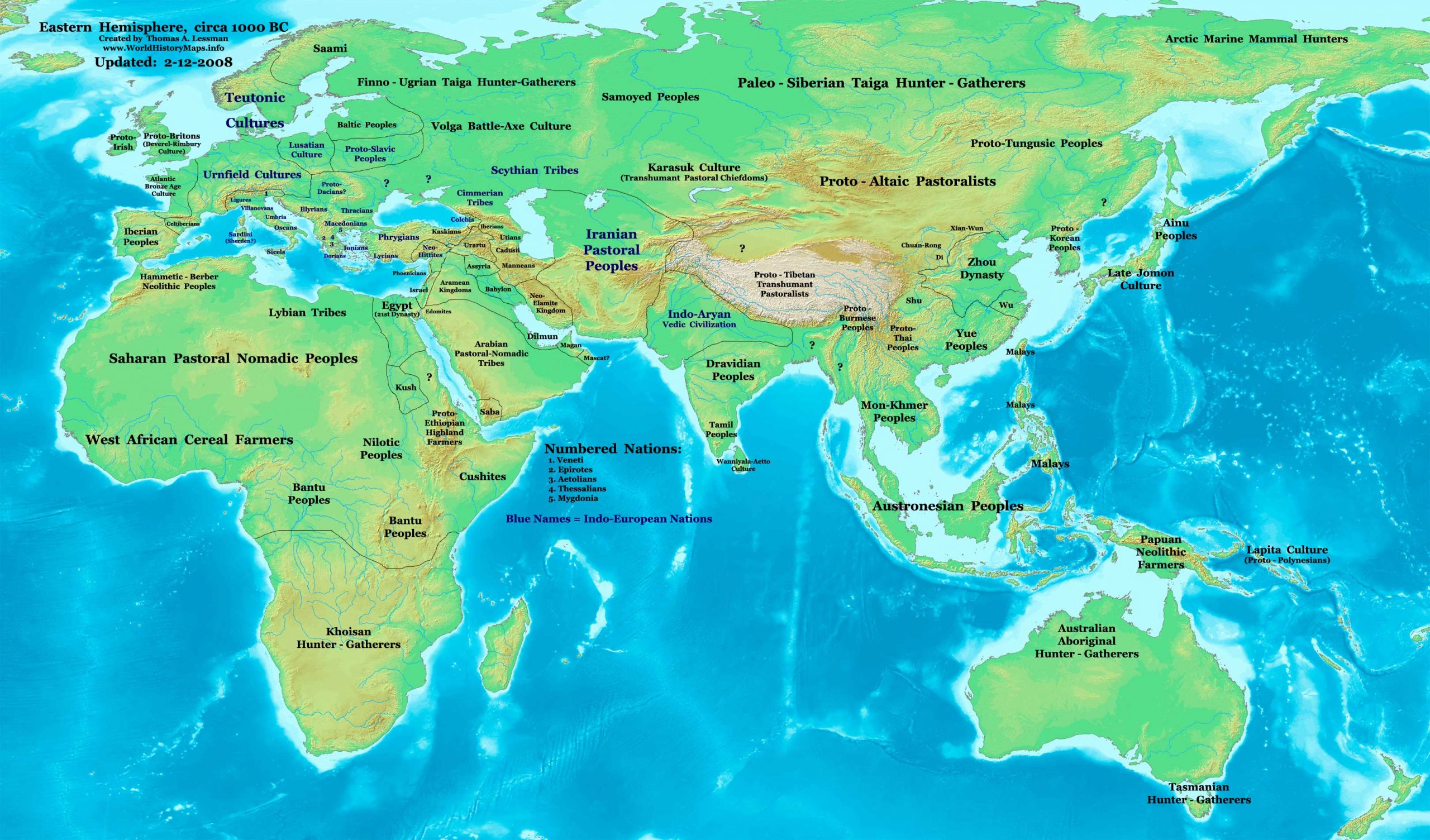
Primary Sources for East-Hem_1000bc.jpg:
- The DK Atlas of World History, 2000 edition. Map of “The World, 1250-750 BCE ”. (Pgs 30-31).
- User:Briangotts. Map of the “World_1000_BCE.png”. Available on Wikipedia.
I – African information:
* African Tribal locations are derived from:
- The DK Atlas of World History. Map of “The Development of Complex Societies in Africa”. (Pg 160).
(Bantus, Berber Tribes, Chadians, Cushites, Daamat, Garamantes, Gur, Khoisan Peoples, Kwa, Libyans, Mandes,
Nilotic Peoples, West Atlantic Peoples, etc.)
II – Asian information:
* Chinese (Zhou Dynasty) information:
- Albert Herrmann, Ph.D. History & Commercial Atlas of China. Map of “The Chou Dynasty, 11th-9th Centuries BC”.
c. 1000 BC—Phoenician alphabet is invented.
c. 1000 BC—Rice is cultivated in Ancient Japan.
1000 BC—Early Horizon period starts in the Andes.
c. 1000 BC—Chavin culture starts in the Andes.
c. 1000 BC—Paracas culture starts in the Andes.
c. 1000 BC—Historical beginning of the peoples we later know as Illyrians[3]
c. 1000 BC—Rough carbon-14 dating of the Cherchen Man.
Source: Wikipedia

